.svg)
Satellite Anti-Disaster Information Service

Rapid infrastructure development presents increasing challenges in monitoring and assessing the impacts of natural hazards across expanding areas. As regions grow, conventional methods of inspection and data collection become less efficient, often leading to higher operational costs and delayed responses.
In disaster-prone environments such as Indonesia, these limitations can result in significant economic losses, particularly when timely and accurate information is not readily available.
Our Approach and Technology: LIANA (Land-deformation and Infrastructure Analysis)
LIANA is a service jointly developed by SKY Perfect JSAT, Nippon Koei (NK), and Zenrin to monitor slope and infrastructure changes. The service displays a time series of ground deformation in areas the user wishes to check, and evaluates risk based on the Japan Ministry of Land, Infrastructure, Transportation, and Tourism’s standards for ground extension meters and the knowledge of NK.
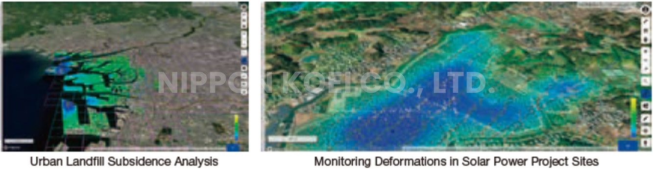
For the web system that provides the result, NK provides the know-how that is easy for users to understand visually and can be incorporated into management operations. Zenrin’s detailed map data was implemented, and the web UI was developed by SKY Perfect JSAT.
By utilizing satellite images, large areas of several tens of square kilometres can be screened at once, which could not be ascertained by surveying alone, thus reducing the cost that corporations and municipalities have spent on maintenance and inspections.
Overview of the Service
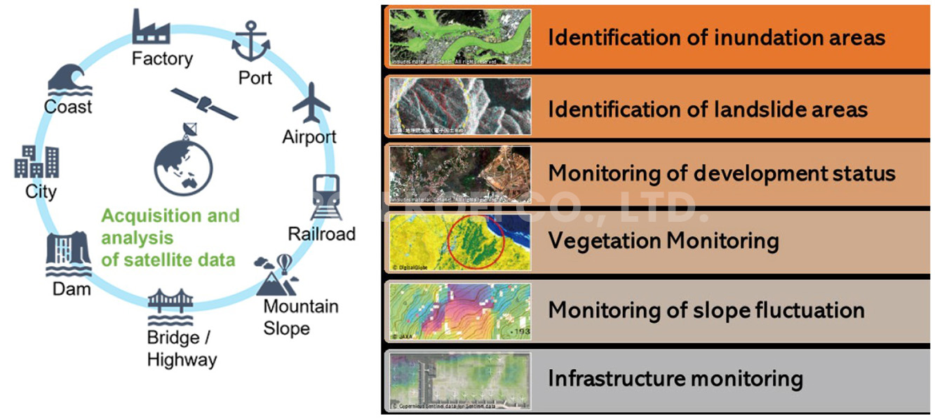
Satellite Anti-Disaster Information System (SADIS)
SADIS is the countermeasure solution developed through the integration of satellite-based technology. It enables a comprehensive and continuous understanding of infrastructure conditions across various sectors.
From dams and transportation networks—covering ports, roads, and airports—to other critical assets, satellite data provides a wide-area perspective that is difficult to achieve through conventional methods.
Through this technology, key indicators can be monitored effectively, including water inundation, ground displacement, infrastructure development status, and vegetation conditions. These insights are essential in identifying early signs of potential hazards such as flooding and rainfall-induced landslides, while also supporting long-term infrastructure performance assessment.
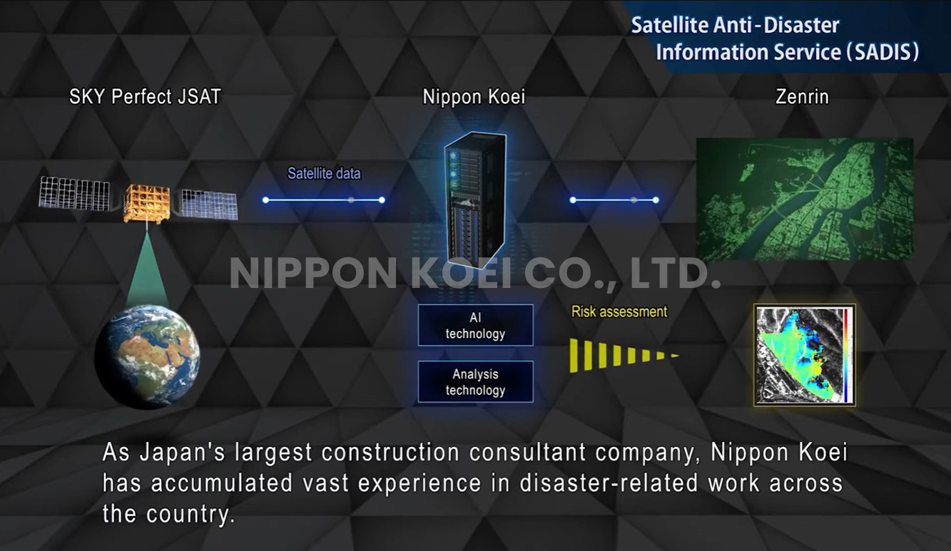
Beyond monitoring, satellite information serves as a reliable data input for our consulting services. By integrating these insights into technical analysis, we support more accurate measurement, informed planning, and data-driven decision-making processes.
This approach strengthens every stage of disaster management:
• Before a disaster, through risk assessment, mitigation planning, and early warning system development
• During a disaster, by supporting situational awareness and response planning
• After a disaster, by enabling damage assessment and guiding recovery and restoration strategies
By combining satellite technology with engineering expertise, we enhance the ability to manage risks more proactively, improve operational efficiency, and deliver more resilient infrastructure solutions.
Explore Our Satellite-Based Solutions for Disaster Management in the Video Below.


.png)
Jakarta Representative Office